By Chad Ingram
Published March 28 2019
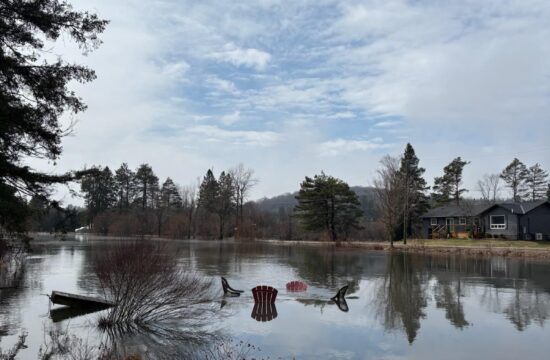
The snowpack in the area is above average for the time of year as the spring freshet approaches.
“Current snowpack is measured to be above average for this time of the year and may result in localized melt and run-off with the warming temperatures and precipitation” reads an email from communications staff with Parks Canada.
Parks Canada operates the Trent-Severn Waterway the feeder system which includes a number of lakes and rivers within Haliburton County. Water from more than 25 reservoir and flow-through lakes funnels into the Gull River through downtown Minden and out into Gull Lake.
While levels on the lakes are so far below average the river is running above average.
“Water levels on the lakes in general are below average” according to Parks Canada. “Recent dam operations to reduce water levels in some reservoir lakes have been implemented in response to the upcoming forecast conditions which have resulted in increased flows on the Gull and Burnt Rivers. Flows on the Gull River are above average and average on the Burnt River.”
After a warm spell earlier in March temperatures have returned to more seasonal norms lately. With warming temperatures and precipitation levels will rise throughout the spring.
The Ontario Waterways InfoNet tool on the TSW website allows residents to monitor levels and can be found at https://www.pc.gc.ca/en/lhn-nhs/on/trentsevern/info/infonet.
“The InfoNet contains background information on water management practices water management updates frequently asked questions about water management various reports on water management and the most recent water levels of lakes along both the Rideau Canal and the Trent-Severn Waterway” the email from Parks Canada reads.
“Of specific note is the water levels tool within the InfoNet which provides lake levels data from the last 30 days and graphic representation of levels for the current year. The information comes from hydrometric gauges located at key points along both waterways and is vetted by trained and experienced Parks Canada water management staff. This information is intended as supplemental information only. Stakeholders should continue to refer to their respective Conservation Authority or the Ontario Ministry of Natural Resources and Forestry as the primary source for relevant flood forecasting information specific to their area.”
Extreme flooding along the Gull River in both the springs of 2013 and 2017 put the Township of Minden Hills into a state of emergency.